Showing posts with label hiking. Show all posts

Saturday, March 7, 2009

Hike on Cabe Lands Access & Eno Quarry

We took advantage of the 80 degree day and hiked down to the old Eno Quarry. I'd never seen it before and it had always sounded intriguing to me, especially after I read this article in the Indy recently.

A little about the area is here.

As you enter, you can pick up a map and see a some items of interest on a covered bulletin board (click to make the pic larger):


Much of the trail is rooty and rocky, but my hiking partner did okay in her tennis shoes. There is a fair amount of uphill/downhill but nothing too strenuous. The trail is considered "moderate."


After a while, you'll get to the big scary warning sign about the Quarry:


Continue on down the trail and soon you'll hear frogs and crickets loudly singing. Water is close. The Quarry is close.

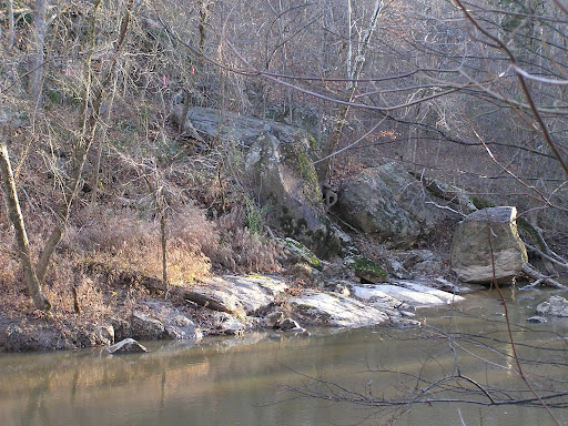
Right before the payoff of seeing the Quarry up close, you have to stone-step over a little creek. The stones looked mighty slippery to me and I was worried about slipping and falling and breaking my leg far down a trail, but I finally got over to the Quarry side (to the steps) safely and snapped a picture.


The Quarry was lovely. I was going to circumnavigate it because a trail does go around it according to the map, but I got my shot of the Quarry and headed back.


above, Eno Quarry 3.7.2009

Hiking out we saw some teenagers hiking in quite obviously going for a swim. I wondered about how cold the water must surely be since earlier this week the temps were 13 or so degrees a couple of nights.

A few other shots from the hike:


Thursday, February 26, 2009

Stuff to do to that gets you out of the house.

Spring is around the corner, right? Tons of stuff always going on through The Eno River Association.

Reading groups, star-gazing nights, various hikes, bird-watching excursion, night-time hikes, hikes for tots, and even a parents-night-out hike.

Here's the monthly calendar with all the dates and details.

Love the Eno!

Friday, January 2, 2009

New Year's Day Hike - Umstead State Park

For the sixth year in a row, some friends and I gathered for an afternoon hike on New Year's Day. This year we chose Umstead State Park. Umstead is fairly large, and there are entrances from both I-40 and Hwy 70. We'd done a hike on the Hwy 70 side before, so we tried the I-40 side, which enters off Harrison Avenue.

We walked the "Company Mill Trail" down to Crabtree Creek and a little beyond. The trail was rocky but well-marked. The air was cold and exhilarating. A nice start to the New Year. At the trailhead:


A sample of what the trail looked like:


Once down at Crabtree Creek, it's easy to see the ruins of the old dam that was in use at least as early at 1810.


There was also a grist mill in use at the site in the 1800s, and the old mill stone is now displayed beside the trail. The mill stone was thought to be lost, but in the mid-1990's it was found in the riverbed downstream from the dam and recovered. A National Guard helicopter helped pull it out of the creekbed and place it beside the trail.


Going along further down the trail you can see the old foundation of what was probably the mill operator's house. Also further down the trail--we didn't get that far--there is a bridle trail that is part of what was the "Durham Road" that is an old, old trail connecting Raleigh and Durham. Evidently an former stage road can be found bisecting this route too and I'd like to go back soon and find it. (This information is via Randy Johnson's Hiking North Carolina, a guide worth owning, in my opinion.)

There is a nice new metal bridge that crosses Crabtree Creek and another map on the other side of the bridge for checking your route. This section of the trail is nice for stopping and enjoying climbing the rocks, checking out the old dam ruins and the mill stone, and listening to the rushing water. The entire loop of the Company Mill trail is 4.8 miles. Down to Crabtree Creek and back is just over 2 miles.


I love to see the surprising green ferns peeking out of the brown leaves in winter.

It's a nice hike and closeby too. The park was very well kept with plenty of maps at the trailhead. A highly recommended afternoon hike.

Monday, May 26, 2008

The foothills of NC as seen from Fancy Gap, VA

We spent a couple of beautiful and cool days "up the mountain" at Fancy Gap, VA just off the Blue Ridge Parkway, relaxing and visiting with family. Totally unplugged. No computer, no cell phone (Verizon Wireless is dead on that mountain, can't get in or out. Annoying and also oddly refreshing, that. The landline works fine at least.) No screaming cable TV. Books, CDs, a Weber grill, a deck with a view, and a bottle or three of wine.

Below, a pic from the deck Saturday night. If you click to make it larger, you can see Pilot Mountain in the distance, the lights of Winston-Salem on the horizon to the left of Pilot Mountain, and the bright lights of Mt. Airy, NC on the right, closer. (You can click it to bring up a larger picture.)


Sunday we decided to go to Foster Falls, Virginia and have a picnic. The New River Trail runs for 57 miles and 39 miles are along the New River, which may be one of the oldest rivers in the world.


You can walk all the way across the New River at Foster Falls on this, and other, ledges that form the gentle 'falls' here. It's fun to do, but the rocks can be slippery if you don't have on good, grippy sandals.


We went for a hike along the New River Trail and saw bicyclists, horse-riders, and other hikers. Below is the tunnel at Austinville on the New River Trail. I found out that Austinville was named for the Austin family who owned the lead mines at the river for a couple hundred years. Stephen F. Austin, the son, moved to Texas as a young man and later became known as "the father of Texas." You know, the guy that Austin, Texas was named for.


After a full day, we enjoyed brats on the grill. Yum. (Sorry, couldn't resist a food pic.)


The wild blaze azaleas and the rhodies are blooming right now too.


Friday, February 1, 2008

V-J Day at Penny's Bend?

Hiking through the woods at Penny's Bend Trail recently, a couple of trees near the river caught my eye. To me they looked very much like a famous photo (Alfred Eisenstaedt's 1945 LIFE photograph) so I stopped and snapped a picture of the trees, to compare to what I was seeing in my mind's eye.


"If I could tell the story in words, I wouldn't need to lug around a camera." ~Lewis Hine

Wednesday, January 2, 2008

New Year's Hike at Penny's Bend

One of my favorite hikes along the Eno River is Penny's Bend. It's about a 45 minute hike and follows along a severe bend in the Eno. It looks like this from the air:


Here's a couple of pictures from yesterday:


Happy New Year, Durham!